National Weather Service Warns of Possible Long-Track Tornado Outbreak Friday in Indiana, Kentucky, and Illinois
This morning, I woke up to thunder. Luckily, it only lasted a few minutes but here it is at 6 AM and I'm awake. So, I decided to check on the storm system coming through this afternoon. Yikes, the National Weather Service in Paducah is being very clear that you need to make plans and arrangements now because they are warning of a possible tornado outbreak.
SOUTHWEST INDIANA, WESTERN KENTUCKY, SOUTHERN ILLINOIS
A dangerous outbreak of severe thunderstorms, including strong long-track tornadoes, is possible this afternoon through late tonight. It is absolutely critical that you are vigilant and have your tornado safety plan ready to go at a moment's notice.
In a Hazardous Weather Outlook Statement, they warned the area of a potentially dangerous situation:
The potential exists for scattered to numerous severe thunderstorms this afternoon and early tonight. The highest risk is from mid-afternoon through late evening. A few long-track strong tornadoes cannot be ruled out, mainly from southeast Missouri eastward across southern Illinois and southwest Kentucky. Large hail and damaging winds are also significant hazards. The storms will race east-northeast at up to 70 mph. This is a potentially dangerous situation. Remain alert for weather watches and warnings.
Outside of thunderstorms, all areas can expect southwest winds will increase to 20 to 30 mph with gusts to 40 to 50 mph. A Wind Advisory is in effect for this afternoon and early tonight.
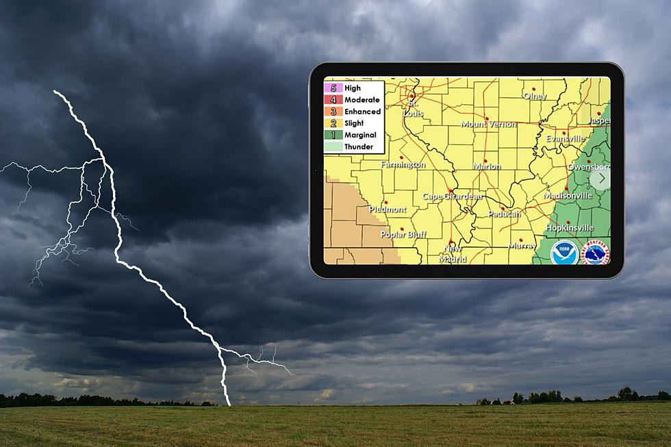
Most of the region has been upgraded to a moderate (level 4 of 5) risk of severe thunderstorms today. The message remains the same: Be vigilant, have your tornado plan ready, and be ready to act if you receive a Tornado Warning.
NORTH / CENTRAL KENTUCKY
A strong storm system will move across the region this evening into the overnight hours. There is a conditional risk for strong to severe storms during this time period, with scattered instances of damaging winds and spin-up tornadoes in southern Indiana and central Kentucky being the primary severe hazard. One limiting factor could be if there isn't enough fuel for thunderstorms to stay strong east of the I-65 corridor.
CENTRAL INDIANA
Central Indiana is now within the Moderate Risk for severe storms this evening. Damaging winds are expected along a line of storms along with isolated tornadoes. Additional severe storms are possible ahead of the line.
CENTRAL ILLINOIS
Early afternoon update on today’s severe weather threat: Two rounds of severe weather are expected today, the first this afternoon and the second this evening. All modes of severe weather are possible, including destructive winds, several tornadoes, and damaging hail. Storms will be moving very fast today. Have multiple ways to get weather warnings today and take shelter quickly if a warning is issued for your area!
Previously, they posted the below graphics.
HOW TO PREPARE FOR THESE POWERFUL STORMS
If we've learned anything about the tri-state it's that when we are told to plan for severe weather, we need to plan for the worst-case scenario because oftentimes it is.
The NWS also has some advice on how to do just that.
With severe weather in the forecast Friday, don't get scared...be prepared! Today would be the perfect time to adjust any plans you might have for Friday afternoon and Friday night, ensuring you have multiple ways to receive warnings, and getting your storm shelter ready in case you need it. If you're not sure what the best shelter is, follow these guidelines to ensure you and your family stay safe.
MAKE SURE YOU CAN RECEIVE ALERTS
Make sure you have a weather radio handy. If you don't have one, you can get one today at a sporting goods store or big box store.
Make sure you can receive alerts on your phone. Here are directions on making sure they are on. You can also register at codered.org To create your account and set up your registration to receive CodeRED alerts, you can visit Public.CodeRED.org and follow the directions provided to register to begin receiving alerts.
And make sure you download our app and turn on alerts for more updates as they become available from the NWS and Eyewitness News.

MAKE SURE YOU HAVE A TORNADO SAFE-SPACE READY
You'll also need a tornado safe-space. Have a plan in place before you get a tornado warning. The CDC recommends, "Go to the basement or an inside room without windows on the lowest floor (bathroom, closet, center hallway). If possible, avoid sheltering in a room with windows. For added protection get under something sturdy (a heavy table or workbench). Cover your body with a blanket, sleeping bag or mattress."
The NWS has some advice on where you should go in the event of a tornado warning.
HAVE CLOTHING & SHOES PREPPED
Get your running shoes and appropriate clothes ready. Have them next to your bed in case you need to make a break for it.
BREAK OUT THE WEATHER HELMET
This can be any kind of helmet you have handy such as a bike helmet or construction hard hat. Better to be safe and a little dorky looking than sorry.
PREPARE FOR OUTAGES
In the event of a power outage, make sure you are ready. Have a working flashlight handy for each person in your household. And make sure your phone is charged as well as your portable battery charger.
TIPS: Here's how you can prepare for power outages
KEEP READING: Get answers to 51 of the most frequently asked weather questions...
KEEP READING: What to do after a tornado strikes
More From WKDQ-FM
